

 Pamir Highway and Wakhan Valley, Tajikistan
Tajikistan stands in contrast to its other ex-Soviet (Commonwealth of Independent States, CIS) neighbours. Where the others all speak Turkic languages and look anywhere between Eurasian and Mongol, Tajik people are Persian. The change in demographic is jarringly visible once encountered.
But never mind Tajik people for now: the Gorno-Badakhshan region on the country, comprising of the eastern half (almost 50% of Tajikistan) yet containing only 3% of its population, is nearly all Pamiri (also Persian) and Kyrgyz. Kyrgyz yurts dot the sparse landscape in the far east, and small, humble Pamiri villages are a blink-and-you’ll-miss-it occurence along the road. Detouring off the Pamir Highway leads you to the Wakhan Valley road, which traces the Panj River (the merged Pamir and Wakhan Rivers) that also marks the border of  Afghanistan for over a thousand kilometres. The Pamir Highway itself, if you stay on it the whole time, goes from Kyrgyzstan through Tajikistan to Afghanistan via a shorter route.
Transport in such a region is very sparse, and so I joined up again with Tom (Ireland) and hopped into a 4×4 with Munar, the manager of the guesthouse we stayed at in Osh, who was also heading to Tajikistan for the first time. With a 1600 km route to Dushanbe and only 6 days to get there, we still managed to squeeze in more than enough stops.

That’s not to say it was all smooth though. Tajikistan is the poorest country in the CIS, and the porous border (read: wade across a river at night) to Afghanistan means a whole lot of illegal drug trafficking (mostly opium) is going on. This means an abundance of police checks and stringent border controls… which were frequently no more than uniformed men asking for bribes. The one time we didn’t want to pay, at the Tajikistan border, they made us wait two hours for nothing while other cars went through, then made up an extra permit we “had” to buy just to go through. I have a feeling that they were mainly harassing Munar, who is Kyrgyz and speaks Russian; if it was just Tom and me or any group of foreign tourists (like the many groups self-driving on the Mongol Rally), they probably wouldn’t have bothered due to the language barrier. Seven times in a week: this is easily the highest frequency I’ve ever seen in all of my travels, and yet this is in a sparsely populated area.
The first two days of the drive, tracing the border fence with China, consisted of long distances that are beautiful but devoid of civilisation. Climbing from the lowlands (1000-2000 m) to mountain passes over 4300 m in one day, we went from toasty weather to chilly winds over what looked like a moonscape. We made brief stops at the two high altitude lakes of Karakul (not to be confused with the one just over the border in China) and Bulunkul, with a Milky Way-lit overnight in between in the village of Murghab, which hosts their bazaar in shipping containers and inexplicably has people trying to stuff goats into burlap sacks. Only a few people in Tajik hats (round, flat, and green, with a small pompom on the side) here: this area is almost completely Kyrgyz. On the contrary, we saw some unintentional KKK fashion out in the fields…


After making a turn off into the Wakhan Valley and reaching the outpost of Khargush, the next thousand kilometres were directly alongside the Afghanistan border. As a country which has been only portrayed as a place of war for the last few decades, being barely 100 m away, separated by a river, and literally able to wave to the people on the other side (and have them wave back!) is an absolutely surreal feeling. Sure, the Wakhan Corridor of Afghanistan is generally safe (although one of its borders has been closed recently due to a Taliban surge) compared to the rest of the country, and we met a handful of tourists with details on visiting Afghanistan, but it’s still such a clash from my mental image of the place.


The Wakhan Corridor, an odd little arm sticking out of the rest of Afghanistan, was actually created by the Russian and British Empires during a late 1800s-era cold war known as the Great Game, where each state was afraid of invasion from the other. Russia, controlling all of Central Asia down to Tajikistan, and Great Britain, controlling India (which back then included what is now Pakistan), ended up using Afghanistan as a buffer state in between them, gifting it a thin stretch of land both remote and poor in resources. Barely 100 km of land from north to south now separates independent Tajikistan and Pakistan.


And the Wakhan scenery on both sides is absolutely idyllic: green farms, trees, and humble houses (a little less humble on the Tajikistan side) line the bottom of the valley, while mountains over 7000 m jut suddenly from the ground. The people on both sides are Pamiri, and it’s a travesty that they can’t cross the river/border freely since it’s clear they’re related: some crossed over to Afghanistan before the border was drawn up, and now they can no longer return. The only difference between both sides? Tajikistan has a nicer road and more villages hooked up to electricity; Afghanistan seems to have precarious drops next to thin gravel paths.
As for the Pamiri people in general: while also Persian, they identify separately from Tajiks (in contrast with China, who groups them both together), but find themselves and their languages threatened by the national presence. In 1992, they even briefly declared an unrecognised independence and fought a war against Tajikistan. While Tajiks are Sunni Muslims, Pamiris are Ismaili Shia, and when the region found itself utterly neglected in poverty, the only people stepping in to help were those of the Aga Khan (the top Ismaili Shia imam, a direct descendant of the Prophet) and his foundation, who remain extremely revered. Some noticeable differences in their religious practice: instead of five times a day, they pray twice, and instead of mosques, they have prayer/meeting halls called jamoat khana.
The Pamiris are also very friendly and hospitable, operating guesthouses out of their homes with room and half board, offering practically all the fruit you could pick from their gardens, and pointedly eating dinner only after all their guests already have. Their houses are beautiful, with ceilings adorned with four rotated squares symbolising the four elements (earth, air, water, fire), and walls covered in carpets.


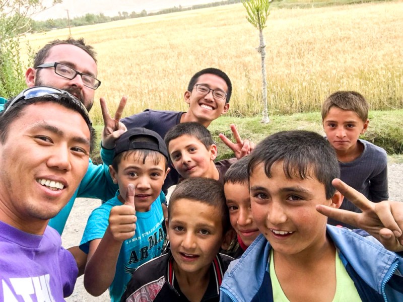
And as we pass through the villages on the only road, possibly as one of the very few cars going through the area each day, children yell out hello (in English!) and chase us, adults chatting on the roadside give a friendly wave (as they stare), and farmers in the field stop their work at the sound of a car and also wave, scythes still in hand. As Tom put it, we felt a bit like the Queen of England, waving unceasingly to the crowds. We also picked up a few hitchhikers here and there, knowing the extremely long distances they have to walk otherwise, whether to buy something or to lead their livestock to graze or to go home.
Their culture and locale has been influenced by wildly disparate groups, however. In Langar, we climbed up a steep hill to check out some petroglyphs, primarily of hunters. It seems the significance of such an archaeological site was lost amongst the locals until recently though: alongside the ancient petroglyphs are some, let’s say… modern ones.

Down the road 5 km is the village of Zong, and up the hill behind it for 8 km after that is the even smaller village of Dirch, whose locals walk down to and up from Zong just to buy stuff. Guided by a local elementary school teacher, a 47-year-old man who completely schooled us in terms of fitness, we climbed up an exhaustingly and precariously steep slope for an hour to reach the top, home to the ruins of a fortress of unknown origin and some formerly-inhabited caves. These caves were used as homes by some miners (locals? Russians? who knows) looking for gold in the area: while one cave was relatively roomy and even had multiple primitive levels built into it, another was straight-up claustrophobic, requiring me (the only one of us other than our guide who would fit) to crawl through dust-laden tunnels and holes with steep drops difficult to see even with three lamps. Both caves had clear evidence of habitation in the form of discarded animal bones and hides… though it was pretty dark in there to see it!


As the climb we took was too steep for us to comfortably go down, our guide took us the long way, passing through farmers’ fields (including his own) and the village of Dirch itself, settled on a hilltop with an idyllic view of the mountains across the river in Afghanistan. If I didn’t know any better, this may as well have been Switzerland. The many views of the valley that we got in our hikes and drives were consistently stunning.


Further west down the road is Vrang, with a Buddhist stupa — a pyramid of stones. Too exhausted from the Dirch hike, we didn’t climb up to it, but we did get swarmed by kids when we stopped at the side of the road…
And out in Yamg, there’s a museum dedicated to the Sufi scholar, astronomer, and musician Mubarak Kadam Wakhani. Dedicated to spreading Ismaili Shia Islam to the people, he managed to write (with paper and ink he made himself) books about the faith and successfully hid them from the Soviet authorities during their campaign against religion. His house, preserved from the late 19th century, is a beautiful example of a traditional home, and the caretaker showed us some of his artifacts and played his very unique-looking instruments for us, while also pointing out the traditional Pamiri-Ismaili symbols like the ibex skull, used commonly in shrines where offerings are made (another Ismaili thing). Outside, there’s even a solar calendar, indicating the spring equinox every year when the sun shines directly through the hole. For the caretaker’s grandson, well…


The fourth day, we stopped by the 3rd-century Yamchun Fortress, built by fire-worshipping Zoroastrians and shockingly still sturdy, before heading to the next-door Bibi Fatima hot springs, named after a daughter of the Prophet Muhammad. (Talk about a clash of faiths!) The hot springs require complete nudity — throw away any preconceived notions of what “modesty” means to Islam here, though they alternate half-hour intervals for each gender. With the water just a smidgeon below “too hot to handle”, it was quite a relaxing experience nonetheless, especially after the previous day of steep hiking! There’s a small, womb-like cave in the spring’s rock wall that men and particularly women like to climb into — not just for fun, but because it’s reputed to boost fertility. I just enjoyed hanging out under the steaming-hot “waterfall” until I felt like I was being cooked — usually a matter of seconds.


And not far from Ishkashim, the southern border town (whose border has recently been closed), the Khaakha fortress in Namadgut dates back to the 3rd century BC with the same purpose as Yamchun. More interesting for us was the Tajikistani border patrol at the top of the fortress, headed by an ethnic Kyrgyz who saw Munar and invited us up for a view right into the village directly across the river/border in Afghanistan. We waved at some farmers there. They waved back. Same with some people in a car on the parallel road directly across the river, as we continued to try our luck further down our side of the road.


Finally reaching Khorog on the fourth night, the only city in the Pamir region and home to most of its population, we said goodbye to Tom the next morning, who sadly missed out on the weekly market. We didn’t have time to see the town either, with a necessary car repair taking up most of our time. The children, yet again, were the most welcoming people, spotting us from a distance and coordinating a “Welcome to Pamirs!” cry in English.

Every Saturday, when the border is safe, a nondescript building 5 km out of town (on the border post, at the Tajik side of the bridge) holds a very nondescript market — nothing special is up for sale other than basic necessities, many imported from either China or Iran. But what makes this market special is that it’s primarily made up of Afghan merchants and customers! While many of the people were visibly Tajik (Tajik is essentially the same as the Dari language, and more Tajiks live in Afghanistan than in Tajikistan!) or Pamiri, there were also others that clearly looked like neither: different facial features and blue eyes, dressed in Afghan robes. (Pashtuns, perhaps?)


We met a teenager named Mirza, who approached us when he heard us speaking English, which he could also speak: he goes to school in Kabul. Seeing him and others here all relaxed is just… mind-blowing. Perhaps it’s a bit ignorant of me to assume the worst, but hey, they all have lives to live after all, and northern Afghanistan (not Kabul) is relatively peaceful. Mirza was merely happy to chat about nothing in particular, but when I spotted him holding some Afghan afghani (the currency) and asked him how much it was worth and whether I could trade for Tajikistani somoni, he happily obliged.


Others saw us with our big cameras and asked for a “tasvir” (photo, same as in Hindi/Urdu). Yet more invited us to their table to eat some plov and share their vodka… at 11 am. (They’re also Muslim, so uhh…?!) Heh. And when asked where I was from, they were happily surprised to hear “Canada” — seems like there’s still a lot of love for the peacekeepers. And indeed, the market is supported by the Canadian Department of Foreign Affairs. But hey, they reacted just as positively to Munar’s response of “Kyrgyzstan”, so maybe they just like anyone!


And then I realise, as I see everyone blur together, chatting more than doing commerce with each other — this is a border they typically can’t cross. Families must have been divided when the border was formed, and friendships too. Perhaps this is the one morning every week (when safe) that they have this time together to relax and spend time with each other, in relatively-safer Tajikistan. 1 pm, and they’ve all packed up and started leaving. It was time for us to leave too: we had a few more valleys and over 600 km to go to Dushanbe.
