

 St. John’s, Newfoundland and Labrador
It’s worth the trouble.
Yes, the trouble of driving four and a half hours from Halifax to North Sydney, Nova Scotia, paying C$338 for a passenger and vehicle ticket for the 14-hour ferry, eating nothing but peanut butter sandwiches for something like four consecutive meals, sleeping in a chair and on the floor, then driving an hour and a half from Argentia to St. John’s, Newfoundland and Labrador.
I’ve always wanted to go to Newfoundland (and Labrador, but that’s not fitting into this trip because the gravel roads won’t jibe with my tiny rental car). British Columbia is actually further from Newfoundland than England is! Being from one end of the country, it’s only natural that I’d like to see how the other is, but the little I’ve heard — generalisations like its very different accent, the fact that it only joined Canada in 1949, its nonchalance to icebergs and whales, its incredible natural offerings, and its cultural distinction from the rest of Canada — only made me want to see it more.
No matter how you get there or what you do there, it isn’t easy. I’ve run into cross-Canada bikers (many from BC), roadtrippers from all over Canada (primarily Ontarians, Quebecois, and BCians), and people who took the very expensive flight in. Getting around is also next to impossible without a car or the patience to hitchhike over and over again, and distances are incredibly long. Any of these factors are prohibitive enough to reduce tourism from what it could be.
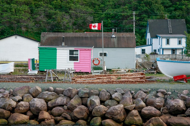
Anyways, St. John’s! One of the oldest cities in North America (founded in 1497), yet with a mere population just over 100,000, it has a small-town vibe to it, but yet a bustling downtown. Just one over from Duckworth and Water Streets (the main business-strip and thoroughfares) begins a series of streets ascending up a steep hill, each packed full of bright and colourful houses — they call it Jellybean Row. No block seems to have an identically coloured house! It is, of course, incredibly pretty, and I spent a fair few hours wandering around the residential neighbourhood.


With fishing being so important in the province’s history, the story goes that fishermen would use the marine paint for their boats (which were paid-for by whoever hired them) to also paint their houses. (Kind of like Valparaíso in Chile, which is also colourful and hilly.) Or maybe it was for their wives who lived in coloured houses to know which boat to look for in the horizon, and to make sure that their husbands wouldn’t be heading to some different-coloured house. Or maybe it was for the wives to keep track of their drunk seafarer husbands by tagging their foreheads with a splash of the same unique paint colour, so that a passerby who sees them passed out on the street would know which doorstep to drag them to. Plenty of local tales around.
Passing through the steeply-perched Battery neighbourhood, I walked up to Signal Hill, site of a British-era fortification perched high above the city, but also involved in 1901 in the first wireless trans-Atlantic radio transmission — an important historical fact somehow completely evading my knowledge before.


Walking down from Signal Hill to the village of Quidi Vidi only took about half an hour yet gave me my first glimpse of Newfoundland’s famed coastal scenery. But never mind that, I wanted to try some beer! Newfoundland is relatively behind in the craft beer scene, but Quidi Vidi Brewery seems to be doing well with their 2% share of the province’s beer sales. Not bad for the 2nd-heaviest drinking province per capita in Canada! (For a population of half a million, they go through 120 million bottles per year.) More interestingly for me, they brew their delicious, Newfoundland-exclusive Iceberg beer with actual melted icebergs, which consist of some of the purest, cleanest water out there, and far better than bottled water. Someone out there that they hire has the job title of “iceberg hunter”. Seriously.
Joined by a couple folks from my hostel, I drove up yet another steep hill to Cape Spear, the easternmost point in Canada and North America, and also a stop on the incredibly gorgeous East Coast Trail. Nothing but steep, rugged, green hills next to the ocean — had I come a month earlier, it would’ve been whales and icebergs all the way. Having whet our appetites, we tried to catch a little more of the coastline by driving down to Witless Bay, but alas, the road only touched the coast every few dozen kilometres and it was getting late, and you don’t want to drive around at night here. (Moose.) Well, backtracking to Petty Harbour for some moose sausage (kind of like beef but more gamey), Iceberg beer (which tastes exactly as light and refreshing as what I’d imagine a beer made from iceberg ice would taste like), and some of the best and freshest fish ‘n chips I’ve ever had isn’t a bad consolation prize.


With no one available to accompany me and keep me alert on the road, I hesitated to do the Irish Loop highway circling the eastern portion of Newfoundland’s Avalon Peninsula — a 7-8 hour drive. Instead, I did an aimless drive to some random coves here and there, taking in the scenery. Cove after cove of colourful shacks perched along hillsides… but oh, did I mention the names? I can’t forget some of the more “colourful” names out there.


I also took the ferry from Portugal Cove to Bell Island, but made the mistake of walking on instead of driving on. “Only 3 km wide!” I thought. Well, when at least 1.5 km of that is walking sharply uphill on an unusually hot day to get into the town of Wabana…that kills about 45 minutes just getting to or from the ferry stop. Oops.


Too exhausted to do anything else, but too reluctant to do nothing, I begrudgingly went on a tour of the iron ore mines, which were at least underground and an opportunity to cool off from the sweaty walk. I’m super glad I went with it, because it was surprisingly informative and eye-opening into the history of both Newfoundland and Canada. Heck, I didn’t even know Newfoundland (putting aside Labrador here) had any industry other than fishing.
Mining began in the 1890s, and it sure wasn’t an easy job, especially in a fully underground operation. At first, workers didn’t even have helmets — just cloth baseball caps with candles tied onto them for light. Only after a decade or two did they move onto seal oil lamps, then something akin to a forehead-mounted flamethrower, then finally real helmets with battery lights. And oh, it’s pitch black down there. The main tunnel (slippery from rainwater flowing in) had mine carts operated by people on the surface who didn’t see what was going on, and people would have to hop off of it whenever it got to their stop. Unlucky people working in or near the main tunnel during a derailment or cable snap often ended up with amputations (as had happened to an arm of the grandfather of our guide) or just ended up dead and in pieces.
As for the “stops”, well, think of it as city blocks, with each block being a pillar of iron ore left behind to support the roof of the mine. By the end of it all, the mine was nearly 2.5 miles (4 km) long at the main tunnel, stretching well under the ocean floor past Bell Island, and connected with five other mines width-wise. It’s as big as a small city. We only walked 650 metres down — the rest of the mine is flooded.


Working 10 hour shifts for 6 days a week in the dark does crazy things to you and your eyes, especially during winter with no sunlight exposure at all after work. (Even horses were down there for a month at a time to transport ore, then getting something like a week in sunlight before being sent down again.) Kids were pulled from school and sent down to work as early as 12 years old. All for 10 cents an hour – a wage they had to strike to negotiate, when Canada (Newfoundland was a separate colony with its own laws) had a minimum wage of 12 back then!
The mine shut down in the 1960s as surface mines for iron ore flourished in Labrador — much easier and far less dangerous to extract. Still, this one mine had billions in wealth (and still technically does) that supported the economy of a fledgling Canada.
But with the mine shutdown came an economic downturn, and an outmigration off the island of people looking for work. Bell Island’s population shrunk by at least 75%. And with Newfoundland’s cod fishing moratorium in 1992 lasting through today, that’s the largest industry affected, with thousands out of work and unskilled in anything else. So…more outmigration, but on a provincial scale. But where do you go from there? Alberta. Oilsands. And now, with oil prices tanking…?
So that’s where Newfoundland’s at these days.
Well, enough depressing stuff. More drinking. (Dark joke, but true. Sorry.) That’s what George Street in St. John’s is for. Maybe next time around I’ll actually get around to getting “screeched in”, but I’ll settle for some beer and hostel-folk pub revelry. That’s the “big city” life here, and I’m interested to see what’s outside of it.